(AP) – Researchers will be mapping the availability of aquifer water in seven counties in Kansas.
The Kansas Geological Survey, based at the University of Kansas, has received federal funding for mapping projects in the southwest Kansas counties.
Kansas geologist Greg Ludvigson says drilling in northeast Haskell County could begin as early as June 1.
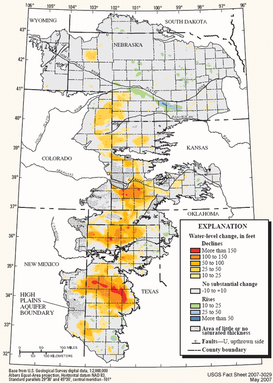
Ludvigson says water levels are dropping quickly around the High Plains Aquifer. That large but shallow aquifer is the source of nearly all municipal and irrigation water in the region.
The $221,000 U.S. Geological Survey awards also will support ongoing geologic mapping in Reno, McPherson, Harvey and Morris counties, and new projects in Jefferson and Atchison counties.